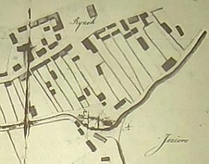
Vištytis – oldest map discoverd
In the search for the origin of the Jews in East Prussia, one repeatedly comes across the border town of Vištytis. It was located directly on the border to East Prussia, today in Lithuania, not far from the border triangle of Kaliningrad (Russian Federation), Poland and Lithuania. Now we came across the oldest map of Wistinetz (1855) that is known to us.
Copy and paste this URL into your WordPress site to embed
Copy and paste this code into your site to embed