East Prussia – “Ostpreussen” or “Ostpreußen”
Work in progress – to display the changes in that area of nationalities and borders. We are talking always about border areas: Germany, Russia, Lithuania, West Prussia, Danziger Freistaat (Free state of Gdansk), Poland, Memelland, Klaipeda Region.Before 1914, Jewish communities,
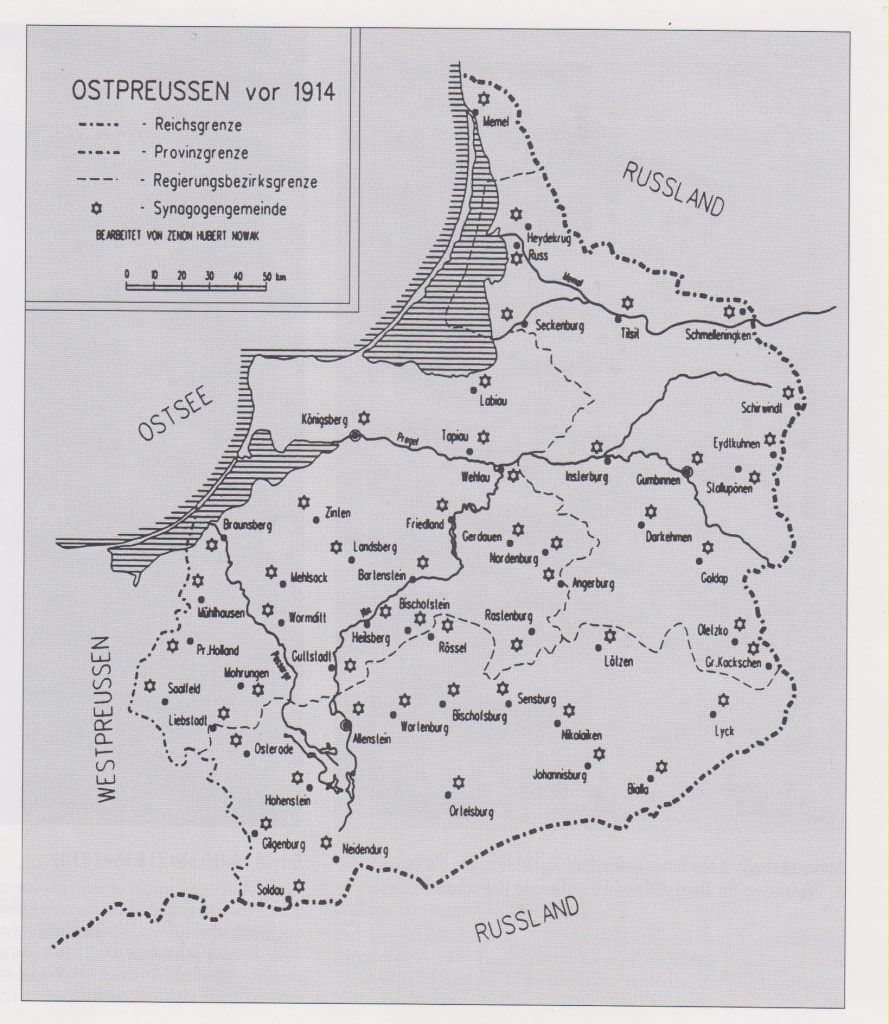 Map according Zenon Hubert Nowak. Source: Juden in Ostpreußen, Ronny Kabus, Published by Ostpreußischen Landesmuseum, Lüneburg, Husum 1998 ISBN 3-88042-888-3
Border Lithuania – EastPrussia (before 1923)
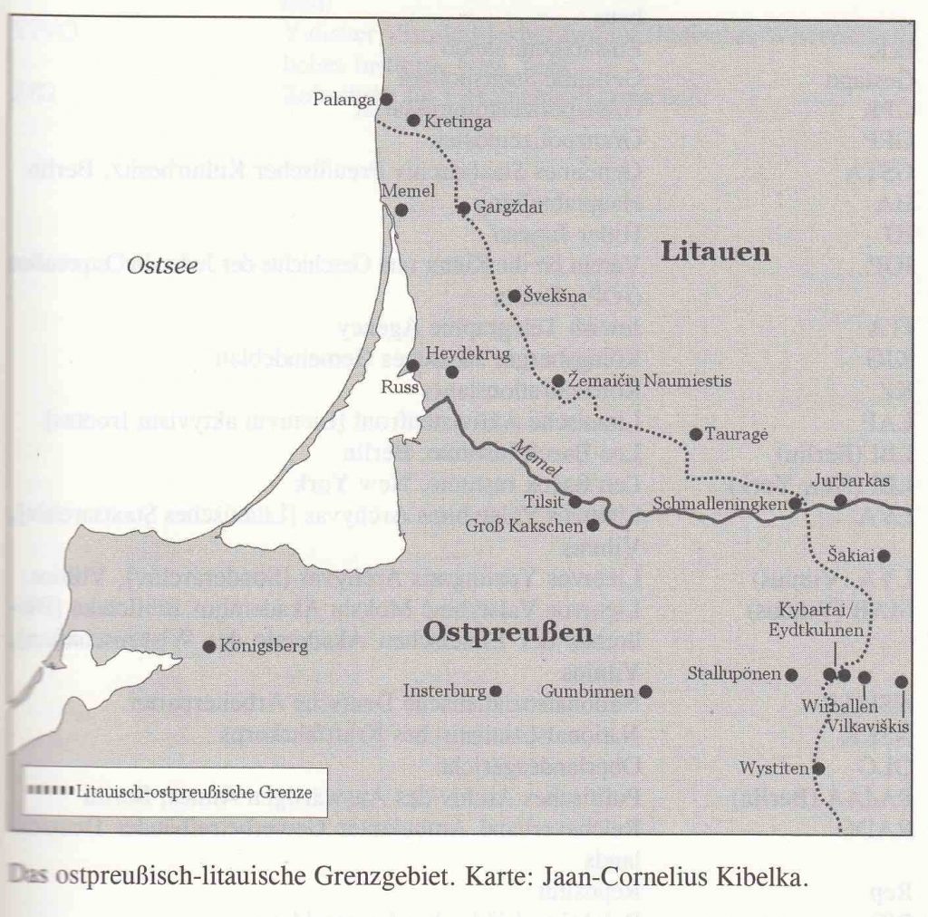 Border Lithuania – East Prussia by Jaan-Cornelius Kibelka, Source: Sabbatleuchter und Kriegerverein, Ruth Leiserowitz, Published by German Historical Institute Warsaw, Osnabrück 2010 ISBN 978-3-938400-59-3
Memelland (Memel Territory) today Klaipėda Region
Memel is the German word for the Neman River (Lithuanian Nemunas). Memel is also the German name for the city, that is called in Lithuanian Klaipeda. The Memelland or Klaipeda Region includes also the northern Part of the Curanian Spit, that divides the Baltic Sea and the Curanian Lagoon.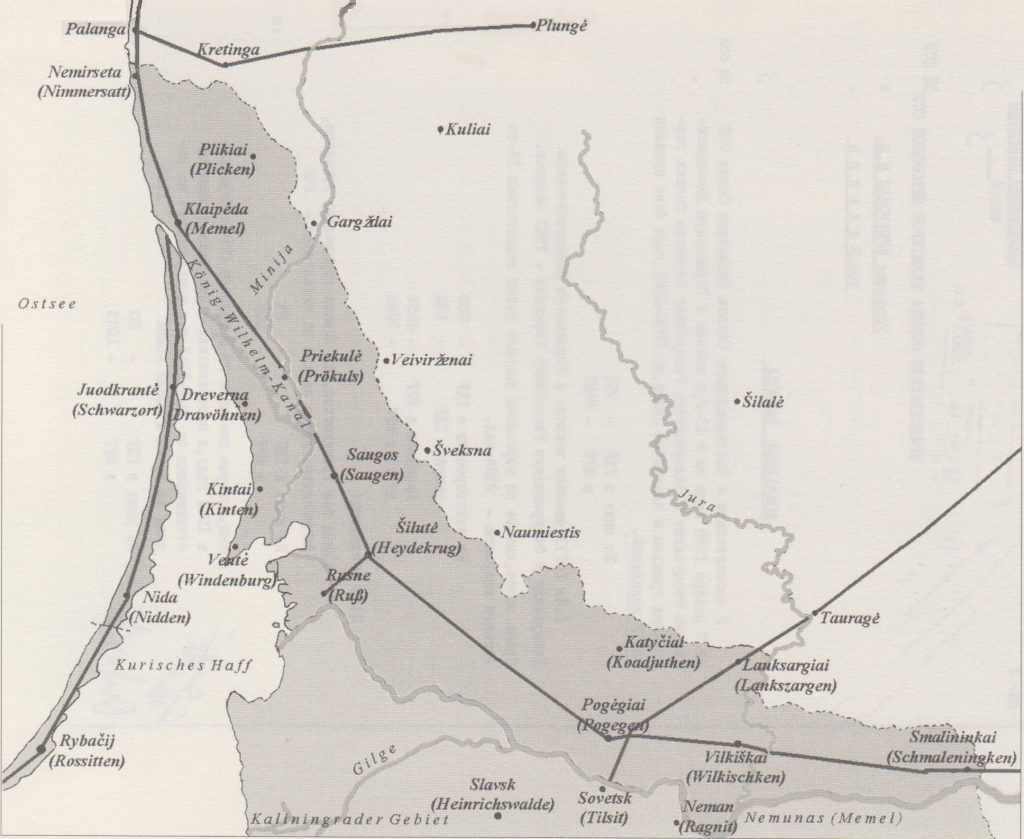 Map by Jaan-Cornelius Kibelka
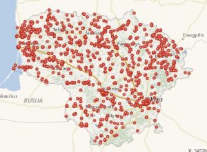
Lithuania: Heritage Department, Real Heritage Search
Link to search map >>